Mount Ridley Nature Conservation Reserve Walks
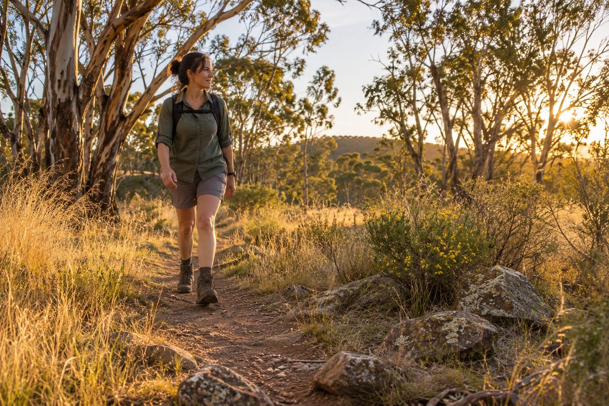
Mount Ridley Nature Conservation Reserve has one main walk: a short, steep climb on unsealed track from Mount Ridley Road to the top of a volcanic cone, through native grassland, ending with wide views across Melbourne's northern plains. It is a Parks Victoria reserve on the northern edge of Craigieburn, Victoria. There is no sealed path, no cafe and no playground. Treat it as a bush walk up a hill, not a park stroll, and it rewards you. Treat it as a park and you will be disappointed within five minutes.
What kind of walk is Mount Ridley?
It is a hill climb on a protected area, so the ground is rough and the grass is left long on purpose. Mount Ridley is a volcanic cone that rises out of the flat basalt country of the Victorian Volcanic Plain. The reserve is classed as a nature conservation reserve, which means its first job is to protect plants and animals. Walking comes second. That order explains everything you will notice on the track: no mowing, no bins, no built lookout, and a surface that is dirt and stone rather than gravel or concrete.
The distance is short. The climb is real. Most adults will reach the top in well under an hour of walking, but the slope and the loose stones put it in the moderate range rather than easy. A hypothetical example makes the point: picture a parent arriving with a pram expecting a loop like the ones along Merri Creek. They would get about fifty metres before the ground stopped them. Picture the same parent with a child in sturdy shoes and a small backpack. They would reach the summit, sit on the grass, and point out the city skyline. Same reserve, different plan.
How do you reach the track and which way do you go?
The reserve is reached from Mount Ridley Road, which runs between Craigieburn and Mickleham in the City of Hume. Entry is from the roadside; check the Parks Victoria page for the current entry point before you set out, because the surrounding farmland is being built on and road layouts in this part of Hume change often.
The route is simple. The track leaves the road, crosses the lower grassland, and climbs the flank of the cone to the summit. You walk up and you walk back the same way. There is no signposted circuit, no distance markers and no side trails worth planning around. Anyone who comes looking for a network of walks will not find one. What they will find is a single clear climb that gets steeper near the top.
Carry water. There is almost no shade on the upper slopes, and the wind on the summit can be strong on days when the lower plain feels calm. Closed shoes matter more here than on most suburban walks because the basalt stones roll underfoot.
What is there to see at ground level?
The grass is the main event, even though most walkers look straight past it on the way up. The reserve holds two native vegetation types. The lower slopes carry Western Basalt Plains Grassland, which is one of the rarest plant communities in Australia. Higher up, where scattered eucalypts stand over grass, the vegetation shifts to Plains Grassy Woodland. Both belong to the broader Victorian Volcanic Plain grasslands that once covered the whole of Melbourne's west and north.
Why does that matter on a walk? Because only a tiny fraction of the original grassland survives. The commonly cited figure is less than one per cent. Mount Ridley is one of the places where it still grows, which is the reason the hill became a reserve instead of a housing estate. When you see kangaroo grass turning copper in late summer, or native lilies and daisies opening between the stones in spring, you are looking at the plain as it was before farming.
Look down as well as up. Basalt boulders and stony rises break the surface across the slopes. These rocks are what kept ploughs off the hill for 150 years, and they are why the native plants survived here when they vanished from the flat paddocks around it. Skinks sun themselves on the stone. Birds of prey work the updrafts off the cone. Kangaroos are sometimes seen on the lower ground in the early morning.
Which direction should you look from the summit?
Face northwest first, because that view is the one most people miss. On a clear day the long blue bulk of Mount Macedon, Victoria stands on the horizon, with the township of Macedon, Victoria at its foot. Mount Macedon is a much larger and older volcanic feature than Mount Ridley, and seeing the two in one line gives a quick sense of how the volcanic plain was built.
Then turn south. The towers of the Melbourne central business district sit on the skyline roughly thirty kilometres away. From this distance they look small, which makes the flat sweep of plain between the hill and the city more striking than the buildings themselves. To the southeast the Dandenong Ranges form a soft dark line when the air is clean.
Closer in, the rooftops of Craigieburn spread south and east. The tree line of the Merri Creek corridor runs through them. The Hume Freeway cuts north. You can read the whole shape of the suburb from up here in a way no map manages.
Air quality decides whether you see any of this. Mornings after rain give the longest views. Summer afternoons bring haze that can hide Mount Macedon completely. Winter, for all its wind, often has the clearest air of the year.
When is the best time to walk here?
Spring, in the early morning. September through November brings the wildflowers, green grass and the mildest conditions on the exposed slopes. Autumn is a close second, with cool air and the grass heads at their fullest.
Summer needs care. There is no shade on the climb, the dry grass carries fire risk and snakes are active. If you walk in summer, go at dawn and keep to the track. Winter walks are cold and muddy on the lower ground, but the reward is the clearest view of the year.
Time of day matters as much as season. Early light comes from behind you when you face Mount Macedon from the summit, which lifts the mountain out of the haze. Late afternoon light does the same for the city skyline to the south.
How is this different from a Merri Creek walk?
They are opposite walks, and that is the reason to do both. The Merri Creek trail through Craigieburn is flat, mostly sealed, shared with bikes and follows water. Mount Ridley is dry, uphill, free of bikes and quiet. Choose the creek when you have a pram, a bike or a dog. Choose the hill when you want a view and want to stand in grassland that has never been ploughed.
Together they show the two landforms that define this part of Melbourne. The creek is where water cut down through the basalt. The cone is where the basalt came from. Walk one in the morning and the other in the afternoon and the geology of Craigieburn stops being an abstract idea.
What rules apply in a protected area?
Stay on the track. That single rule does more for the reserve than any other. Grassland regenerates slowly, and feet that wander off the path crush seedlings and carry weed seeds into clean ground. Parks Victoria manages the reserve under conservation rules rather than park rules, so expect the following to apply: no fires, no bikes off the track, no collecting of rocks or flowers, and everything you bring in goes out with you.
Dogs are the question people ask most. Many nature conservation reserves in Victoria do not allow them because of the impact on native animals and ground-nesting birds. Check the current Parks Victoria page for Mount Ridley before bringing a dog rather than assuming either way. If dogs are not allowed, the Merri Creek trail a few minutes south is the better option for that walk.
Whose Country are you walking on?
Mount Ridley stands on Wurundjeri Woi Wurrung Country. The Wurundjeri Woi Wurrung Cultural Heritage Aboriginal Corporation is the Registered Aboriginal Party for this part of Melbourne and has a formal role in protecting cultural heritage across the area. Volcanic cones on the plain were landmarks and meeting points long before they became reserves. Walk with that in mind. Leave stones where they lie, and if you come across anything that looks like a stone arrangement or an artefact, do not touch it and report it rather than move it.
What do walkers get wrong about Mount Ridley?
Four mistakes come up again and again.
- Mixing it up with other places that share the name. Several hills in Australia and New Zealand are called Mount Ridley or Ridley. This one is in Melbourne's north, in the City of Hume, between Craigieburn and Mickleham. If a search result mentions a different state or country, it is the wrong hill.
- Expecting a built lookout. There is no tower, platform or seat on top. The summit is grass and rock. Bring something to sit on if you plan to stay.
- Treating the grassland as empty paddock. Walkers hurry across the lower ground to get to the climb. The lower ground is the rarest part of the reserve. Slow down there, especially in spring.
- Planning it as a long hike. The walk is short. People who drive out expecting a half-day outing feel short-changed. Pair it with something else nearby and the day works.
How does the walk fit into a day in Craigieburn?
Make it the first thing you do. Walk the hill early while the air is clear, then come down to the suburb. A flat afternoon stretch along Merri Creek balances the morning climb. If your visit falls on a match day, Hume City FC plays in the National Premier Leagues Victoria and is the local club to watch in the evening. For more on what to do across Craigieburn, Victoria and the wider City of Hume, the Craigieburn Fieldnotes home page gathers the guides in one place.
Here is a labelled hypothetical to show how it fits. Say a couple visiting relatives in Craigieburn has a free Saturday in October. They park on Mount Ridley Road at eight, climb to the summit by half past, pick out Mount Macedon to the northwest and the city to the south, and are back at the car before the wind picks up. They spend the afternoon on the creek trail and the evening at the football. Nothing in that day costs more than a coffee, and they have seen the two landforms that explain why Craigieburn looks the way it does.
Your one takeaway
Go early on a clear spring morning, walk straight to the summit, and give yourself ten minutes facing northwest before you look at anything else.
Before you leave the house:
- Check the Parks Victoria page for Mount Ridley Nature Conservation Reserve for the current entry point and the rules on dogs.
- Wear closed shoes with grip and carry at least a litre of water per person.
- Pick a morning after rain for the longest views, or a winter morning for the clearest air.
- Stay on the track on the lower slopes, and look at the grass, not past it.
- Plan a second activity in Craigieburn for the afternoon, because the climb is short.