Mount Ridley Lookout Visitor Guide
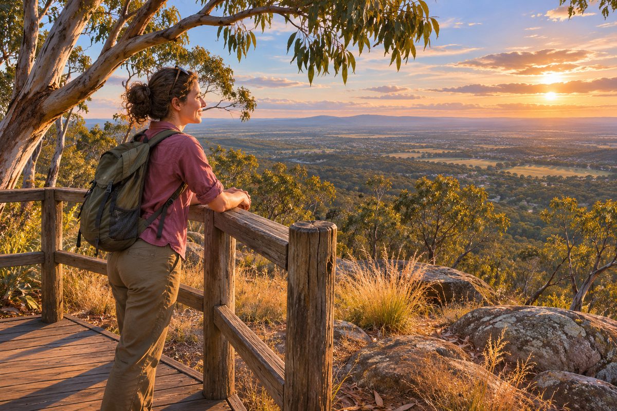
Mount Ridley is a small extinct volcano in Mickleham, Victoria, just north of Craigieburn, and its summit gives the widest open view in this part of the City of Hume. The hill sits inside a grassland conservation reserve, so the visit is less about facilities and more about the view, the plants under your feet and the story of how this ground formed. This guide covers what the lookout actually offers, how to plan a visit without guessing at details, and how to read the landscape once you reach the top. For more local guides from the same area, see the Craigieburn Fieldnotes homepage.
What is Mount Ridley and why does it stand out from the plain?
Mount Ridley is a cinder cone, a type of volcano built from loose scoria that piled up around a vent during a short eruption. It belongs to the Newer Volcanics Province, the field of young volcanoes that spreads across western and northern Melbourne. The plain around it is flat because lava flows spread out and cooled into a wide basalt sheet. The cone stayed as a hump on top of that sheet.
That origin explains why the hill looks the way it does. A cinder cone has steep, even sides and a rounded top, not a jagged peak. It is modest in height compared with mountains, but on a flat plain even a modest rise opens up a long view. Standing on the summit, you are seeing the whole volcanic plain from one of the few natural high points it has.
The ground on the slopes is dark and crumbly where scoria shows through. Water drains fast through it, which is one reason the hill carries grassland rather than forest. The plants that grow here have adapted to thin, dry, rocky soil.
Where exactly is the lookout and how do you get there?
The hill sits in Mickleham, Victoria, on the northern edge of Craigieburn, Victoria. Both suburbs fall inside the City of Hume, the local council area that stretches from Broadmeadows north past the airport corridor. Mount Ridley Road, which takes its name from the hill, runs through the area and is the usual reference point when people give directions.
The nearest major road is the Hume Highway. Locally this stretch is a controlled-access highway, which means you cannot pull off it directly onto side streets. You leave at a signed interchange and then use local roads to reach Mickleham. If you are coming from the city, the drive from central Melbourne to Craigieburn is roughly 25 kilometres, with Mickleham a short distance further north.
Practical details change. New housing estates have reshaped the roads around Mickleham over the past decade, and access points, parking and track conditions can shift as that development continues. This guide does not list opening hours, parking numbers or bus timetables, because those details go stale and a wrong figure is worse than none. Check Parks Victoria for the current status of the reserve and Public Transport Victoria for any bus options before you set out.
What can you see from the summit?
The view is the reason most people climb. From the top, the eye travels across a flat, mostly open plain to distant ranges in several directions. On a clear day, the main landmarks are:
- Mount Macedon to the north-west. This is the largest high point visible from the summit, and the small town of Macedon, Victoria sits at its base on the Calder corridor. The Macedon Ranges read as a blue-grey block on the horizon.
- The Dandenong Ranges to the south-east, a lower, longer line of hills on the far side of the city. They are easier to pick out in the morning when the sun lights their western face.
- The Melbourne skyline to the south, usually a cluster of tower shapes above the suburbs.
- Other volcanic cones on the plain. Several small hills near Craigieburn and further west are cones or lava rises of the same age. Once you know what a cinder cone looks like, you start spotting them.
Clarity depends on the air. Summer haze and smoke can hide Mount Macedon completely, while a cool, dry morning after rain gives the sharpest horizon. If the view matters to you, go after a change in the weather rather than at the end of a hot, still day.
Why does the grassland matter as much as the view?
The slopes and surrounds of Mount Ridley carry Victorian Volcanic Plain grasslands, a plant community that once covered most of the basalt country west and north of Melbourne. Less than one per cent of it survives in good condition. The Australian Government lists the natural temperate grassland of the Victorian Volcanic Plain as a critically endangered ecological community. That makes the patches at Mount Ridley rare in a way the view is not.
Grassland does not look dramatic from a distance. Up close it is a mix of native tussock grasses such as kangaroo grass and wallaby grass, with wildflowers in spring. Lilies, daisies and orchids appear between the tussocks for a few weeks each year, then vanish again. The best time to see flowering is usually September to November, though the exact weeks depend on the season.
Parks Victoria manages reserves of this type across the volcanic plain, and the Mount Ridley reserve exists to protect the grassland rather than to serve as a park with lawns and barbecues. Treat it that way. Keep to formed tracks, leave dogs at home unless signs say otherwise, and do not pick flowers or remove rocks. The surface rocks matter too. Basalt and scoria stones shelter lizards, insects and small native mammals, and turning them over or stacking them removes that habitat.
A clearly hypothetical example shows the difference a visitor can make. Imagine two groups walking the same slope in October. One stays on the track, photographs the orchids and leaves. The other cuts straight up the slope to save five minutes, trampling tussocks and crushing flowering stems. The second group has not just shortened their walk. They have broken the seed set for the plants they stepped on, and on thin volcanic soil those plants recover slowly. Over a few busy seasons that shortcut becomes a bare scar.
Whose Country is Mount Ridley on?
Mount Ridley lies on the Country of the Wurundjeri Woi Wurrung people, who are among the Aboriginal Australians of the Kulin nation. The Wurundjeri Woi Wurrung Cultural Heritage Aboriginal Corporation is the Registered Aboriginal Party for this area under Victoria's Aboriginal Heritage Act 2006. That status gives the Corporation a formal role in decisions about Aboriginal cultural heritage, including on land being developed around Mickleham and Craigieburn.
It helps to understand how that differs from native title. Native title in Australia is a separate legal process under the Native Title Act 1993, through which a court recognises the rights of a group over particular land. Being the Registered Aboriginal Party does not by itself mean a native title determination has been made. The two systems run in parallel. One deals with heritage protection, the other with recognised rights to land and water. Visitors do not need to track the legal detail, but it is worth knowing that the Wurundjeri Woi Wurrung connection to this place is recognised in law as well as in history.
Volcanic hills on the plain were landmarks and lookout points long before European settlement. Open grassland was also managed with fire to keep it productive for game and for food plants such as murnong, the yam daisy. When you stand at the summit and see other cones on the horizon, you are seeing a landscape that people have read and moved across for thousands of years.
How should you plan a visit?
Mount Ridley rewards a short, focused visit more than a long outing. Plan around these points.
When to go
Spring gives wildflowers and green slopes. Winter gives the clearest air and the longest views. Summer is hot and exposed, with no shade on the cone, so go early or late in the day if you visit then. Any season works for the view if the air is clean.
What to bring
- Water, because there is no supply on the hill.
- Sun protection year round. The slopes face the sky with nothing between you and it.
- Closed shoes with grip. Scoria rolls underfoot and the slope is steeper than it looks from the road.
- A wind layer. The summit catches whatever is blowing across the plain.
How long to allow
The climb itself is short. Most people reach the summit within a modest walk from the nearest access point, spend a while taking in the view, then return the same way. Allow extra time in spring if you want to look at plants properly, because the interesting detail is small and easy to miss at walking pace.
Who it suits
The hill suits anyone who can manage a short, steep walk on loose ground. It does not suit prams or wheelchairs on the slope itself, and this guide does not claim any formed accessible path to the summit. If accessibility matters for your group, contact Parks Victoria directly rather than relying on a general description.
What do most guides get wrong about Mount Ridley?
Three mistakes come up again and again.
First, people confuse it with other places. Mount Ridley near Mickleham is a Melbourne suburb's volcanic hill. It is not the Mount Ridley in Western Australia or any other hill carrying the same name. If you are searching for directions, include "Mickleham" or "Craigieburn" in the query to avoid a long drive to the wrong place.
Second, visitors expect a built lookout. Mount Ridley is a natural summit inside a conservation reserve. Do not count on a viewing platform, seats, toilets or a kiosk. The reward is the open view and the rare ground you are standing on, and the sparse setting is part of what protects it.
Third, guides treat the grassland as empty space on the way to the view. It is the most valuable thing on the site. The view can be had from several hills across Melbourne. Intact volcanic plain grassland cannot.
How does Mount Ridley fit into the rest of the City of Hume?
The hill is one of the few natural landmarks in a council area better known for its growth corridors. The City of Hume covers established suburbs such as Broadmeadows and Sunbury along with the newer estates spreading through Craigieburn and Mickleham. Hume City FC, the National Premier Leagues football club based in Broadmeadows, takes its name from the same municipality, which shows how the council identity threads through local life.
For visitors, this matters because Mount Ridley makes a good anchor for a half day in the area. Pair the climb with a walk along the Merri Creek corridor, a visit to the Craigieburn town centre, or a drive north along the Hume Highway toward the Macedon Ranges if the view from the summit has made you curious about what lies on the horizon. Mount Macedon itself has its own lookouts and the Memorial Cross, roughly an hour's drive from Craigieburn depending on traffic.
Craigieburn Fieldnotes covers these nearby places in separate guides, so the Mount Ridley visit can be the start of a longer local route rather than a one-off stop.
What is the one thing to do before you go?
Check the current reserve status on the Parks Victoria website, confirm your access point on a current map, then plan to arrive on a clear morning in spring or winter. Walk the formed track, stay off the tussocks, and give yourself time at the top to pick out Mount Macedon in one direction and the Dandenong Ranges in the other. That single clear morning will tell you more about how this plain formed and who has lived on it than any amount of reading.