Malcolm Creek Walking Trail Craigieburn
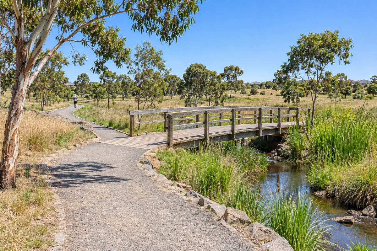
The Malcolm Creek walking trail is a mostly flat shared-use path that follows Malcolm Creek through the centre of Craigieburn, Victoria, and it suits walkers, runners, dog owners and children on bikes who want an easy route away from traffic. The path sits inside a strip of public open space along the creek. Houses and estates line both sides, but the corridor itself is wide enough that you feel like you are in parkland rather than a suburb. There are no steep climbs. Most of the route is sealed. You can join or leave it at many street ends, which makes it simple to walk a short loop or a long out-and-back.
This guide covers where the trail goes, who manages it, what lives along it, how dog walking works, and how to reach it from the train, the Hume Highway or Craigieburn Road. For more local guides, see the Craigieburn Fieldnotes homepage.
Where does the Malcolm Creek trail actually run?
The trail follows Malcolm Creek on a north to south line through Craigieburn. Malcolm Creek is a small waterway that drains the northern growth area and flows south to join Merri Creek. The creek corridor was kept as open space when the surrounding estates were built, and the path was laid along it.
The route crosses Craigieburn Road, the main east to west road through the suburb. South of that crossing the corridor heads toward the Merri Creek junction and the grassland country on the suburb's southern edge. North of it the corridor runs up through the newer estates toward the Mount Ridley area. Treat Mount Ridley here as the hill and suburb on Craigieburn's northern side in Melbourne's outer north. It is not the Mount Ridley or the Craigieburn found in New Zealand, and search results often mix the two up.
Because the path is a shared-use path, expect cyclists as well as walkers. It is designed to let people move through the suburb without using roads, so it doubles as a commuter route for people riding to school, the shops or the station. Walk on the left and keep dogs close at blind corners near bridges.
There is no single official start point. The simplest way to plan a walk is to pick a crossing road, walk the creek in one direction for as long as you like, then turn around. A hypothetical example: a family parks near the Craigieburn Road crossing, walks north for twenty minutes with a pram, stops at a playground on the corridor, then walks back. That gives roughly a forty minute outing on sealed path with no road crossings except the one at the start.
Who looks after the creek and the path?
Two bodies share the job. The City of Hume is the local council for Craigieburn. It manages the parkland, the path surface, the playgrounds, signage, bins and mowing along the corridor. If a section of path is cracked, a light is out or a bin is overflowing, council is the contact.
Melbourne Water is the regional waterway authority. It is responsible for the creek itself as a drainage and flood path, including the channel, the larger wetlands and the water quality work. In Melbourne's northern growth areas, Melbourne Water also sets the rules for how developers must treat creeks when new estates go in. That is why Malcolm Creek was left as a wide green corridor rather than piped underground. The corridor is a working stormwater system first and a park second, and it was shaped so that it could do both.
This matters for walkers in one practical way. After heavy rain the creek rises fast and low sections of path or underpasses can flood. The design assumes this. Do not try to wade through a flooded underpass. Go up to street level and cross at the road instead.
Is the Malcolm Creek trail good for dog walking?
Yes. The trail is one of the most used dog walking routes in Craigieburn, mainly because it is long, flat, away from cars and has grass on both sides of the path. Dogs get variety from the water, the bird smells and the changing open space. Owners get a route they can extend or cut short at any street end.
Lead rules are set by the City of Hume. Across most public open space in Hume, dogs must be on a lead unless the area is signed as off-lead. Signed off-lead areas exist in some parks, and council keeps a current list, so check the Hume website before you let a dog off, because the rules can differ from one reserve to the next along the same corridor. Shared paths are a special case. Even where a park is off-lead, a dog running across a bike path is a hazard for the dog and the rider.
Three things make dog walking easier here. Bring your own bags, because bins are spaced out and dispensers are not always stocked. Keep dogs out of the creek near wetland areas, since those pools are frog habitat, and a swimming dog churns up the water and stirs up birds. In summer, walk early or late. The corridor has young trees along much of its length, so shade is patchy and the sealed path holds heat.
What wildlife will you see along the creek?
More than most people expect from a suburban drain. The creek corridor is a strip of habitat that connects Merri Creek to the open country north of the suburb, and birds and frogs use it as a highway.
Birds
The Australian wood duck is the bird you are most likely to notice. Wood duck pairs graze on the mown grass beside the path and lead strings of ducklings down to the water in spring. They are grazing ducks, so they are often well away from the creek, standing on lawns. Other regulars include magpies, magpie-larks, galahs, little corellas, willie wagtails and, around the wetlands, white-faced herons and the occasional cormorant. Dusk brings swallows and martins hunting insects low over the water.
The growling grass frog
The growling grass frog is the reason parts of this corridor are built the way they are. It is a large green and gold frog named for its low growling call. It was once common across Melbourne, and it has declined so sharply that it is now listed as a threatened species under both national and Victorian law. The Merri Creek catchment, which includes Malcolm Creek, holds some of the frog's most important remaining populations in the north of Melbourne.
Planning for the northern growth area includes a conservation strategy for this frog. That is why you see ponds, reed beds and fenced wetland cells along creek corridors in new estates, and why some areas are signed to keep people and dogs out. The frog needs still water with plants for breeding and open ground to move between pools. Walkers rarely see one, but on warm nights in spring you may hear the growl from a wetland near the path.
Craigieburn Grasslands
South of the suburb, where Malcolm Creek meets Merri Creek, the creek corridor runs into the Craigieburn Grasslands, a nature conservation reserve of native volcanic plains grassland. This grassland type once covered the plains north and west of Melbourne and is now one of the rarest habitats in Australia. It supports endangered species including the golden sun moth and the striped legless lizard. The reserve is managed for conservation first, so access is limited compared with the creek path, and dogs are not welcome. Walk the creek trail for the easy outing and treat the grasslands as a place to look into from the edge, with signs explaining what is there.
How do you get to the trail by train, car or bike?
Craigieburn railway station is the end of the Craigieburn line on the Melbourne metropolitan network. The station sits on the west side of the suburb near Craigieburn Road. From the station, head east along Craigieburn Road to reach the Malcolm Creek crossing. It is a walk rather than a step out of the station, so allow time, or ride a bike from the station if you have one. Check Public Transport Victoria for current train times rather than relying on any article.
By car, Craigieburn is reached from the Hume Highway, which runs along the suburb's western edge, and from the Hume Freeway via Craigieburn Road. The Craigieburn railway line and the highway together form the western boundary of the older part of the suburb. There is no dedicated trail car park. Park in a side street near a crossing road and walk in.
By bike, the shared-use path connects to other local paths and to the wider Merri Creek trail system to the south. That makes it possible, with some road sections, to ride from Craigieburn toward the inner north along creek corridors. Riders should slow for walkers and ring a bell before passing, since many users have dogs or small children.
What can you add to a creek walk?
The trail works well as one part of a longer outing. The Craigieburn Regional Aquatic and Leisure Centre sits on Craigieburn Road, so a morning walk and a swim can be combined without much driving. The shopping centre on the eastern side of the creek has cafes for a coffee after a walk; the Fieldnotes guide to cafes in Craigieburn covers those in detail, so they are not repeated here.
Sport is close by too. The City of Hume is home to Hume City FC, the region's National Premier Leagues football club, which plays its home games in Broadmeadows a short drive south. Local junior clubs use ovals and pitches on reserves beside the creek corridor on weekends, which is why parking near the path can be tight on Saturday mornings.
A hypothetical plan for a visitor arriving by train: walk from Craigieburn railway station along Craigieburn Road, join the creek path and head north for half an hour, cross back to the shops for lunch, then return the same way. That gives a two to three hour outing with no car needed.
What do most guides to Malcolm Creek get wrong?
Three things stand out.
First, people describe the creek as a bush trail. It is not. The corridor is engineered open space with a sealed path, mown grass, planted trees and constructed wetlands. That is a feature, not a flaw. It means prams, wheelchairs and small bikes manage it easily, and it is well used and visible for most of its length. If you want rough bush, this is the wrong trail. If you want a safe, easy walk close to home, it is the right one.
Second, guides treat the creek as if it always has water. Malcolm Creek is a small intermittent waterway. In a dry summer much of the channel is dry or reduced to pools, and the wetlands are the only reliable water. After rain it can run hard and brown. The walk changes a lot with the season, and the best wildlife watching is in spring when the ducklings are out and the frogs are calling.
Third, the trail is often confused with the Craigieburn Grasslands walk. They connect, but they are different experiences with different rules. The creek path welcomes dogs on lead and bikes. The grassland reserve is for conservation and has restricted access. Knowing which one you are heading for saves a wasted trip.
What should you do now?
Pick a crossing road on Craigieburn Road, walk the creek path north for thirty minutes with your dog on a lead, and turn around at the first wetland you reach. That single walk shows you the surface, the birds, the frog habitat and the links to the rest of the suburb, and it tells you whether a longer loop or a ride to the Merri Creek junction is worth planning next.
- Check the City of Hume website for current dog lead and off-lead rules before you go.
- Check Public Transport Victoria for train times if you are coming from Craigieburn railway station.
- Bring water and dog bags, and avoid the middle of the day in summer.
- After heavy rain, cross at street level rather than through underpasses.